Travelogue – The Peloponnese 2021
TRAVELOGUE
The Peloponnese 2021
Period: 7 September 2021 – 23 October 2021. Distance: 8.290 km.
Finally, we were able to travel again, although Covid-19 was still around. We have been vaccinated, but we strictly applied the necessary safety measures. For us, that meant keeping distance, wearing masks in public places, taking hygiene seriously, staying in our own bubble as much as possible
Photo series
We have a very extensive photo series of our trip on SmugMug. Click here for the link. It was a long journey which resulted in many photos. In addition we have added photos of the trip that we made in 2022 to the same series. Please make your own selection. Here below we have selected a few photo’s out of the series.


Route
Our destination was the Peloponnese and the island of Kythira in Greece. The approach route to Greece was: Zeeland (NL) – Floreffe (B) – Ecomuseum d’Alsace (FR) – Monticelli d’Ongina (IT) – Acqualanga (IT)- Termoli (IT) – Vieste (IT) – Manfredonia (IT) – Castel del Monte (IT) – Bari (IT).
In Bari we boarded the Superfast Ferry to Igoumenitsa. We had deliberately chosen for Camping on Board. You can stay in the camper during the trip, and you have electricity on board. This is the most practical way for us to sail when having the dogs with us. The camper is their second home, and it gives less stress than when we are on deck. You don’t have to imagine anything romantic at Camping on Board. You are wedged between trucks and other campers; it is warm and there is a lot of noise.
As a guide we used the Peloponnese’s route that was mapped out in the WOMO guide, but we regularly deviated from that. Because we have lived in Greece, and have traveled on the Peloponnese more often, we did not visit Olympia and Mistras this time. Of course, both are worth a visit!
From Igoumenitsa we descended, via the Rio Antirrio bridge, to Patras. Via the West Coast of the Peloponnese we drove, with all kinds of wanderings, south to Neapolis. In Neapolis we took the boat to Kythira, there we have been for four days. Then we drove via the East Coast to the north of the Peloponnese. After we had rounded the Pelopónnesos we drove via the Corinth Canal towards Epirus, where autumn showed its most beautiful side.
In a period of three days we drove from Bari, via Baraccola and Como, back to Zeeland.
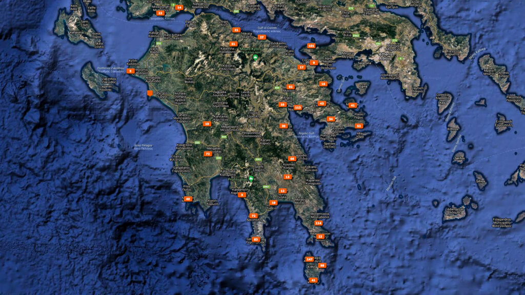
The map below shows where we took our photos, and which gives a good indication of the route that we followed as well.
Highlights
The Peloponnese, the large peninsula in southern Greece has everything that makes Greece so attractive. Ancient excavations, countless beaches, vast mountain landscapes, deserted regions, quiet monasteries.
Messene or Ancient Messene is in a fertile valley in a beautiful setting at the foot of Mount Ithomi and 35 kilometers northwest of Kalamata in the province of Messinia in Greece. Ancient Messene was a heavily fortified city and built on the ruins of the ancient city of Ithome to defend against the Spartans.
There are still many remains of the old town of Messene to see, in recent years parts of the excavation have been reconstructed and restored. Sights include the ancient walls, the theater, the agora, the asklepion (hospital, sanatorium), the stadium and gymnasium and the shrines of Ithomi.Around Messene a defensive wall was built with a length of nine by seven kilometers with several watchtowers. The Arcadian gate marked the main road to the province of Arcadia and is still the main road to Mavromati.
The excavations of Messene are impressive. We think it is one of the most impressive archaeological sites in Greece. We were there in 1999 and a lot of work has been done by the archaeologists since then.It was magical to be the only visitor in the early morning and to walk through this archaeological landscape and photograph it.
The Temple of Apollo Epicurius in Bassae is located high, 1130 meters, in the mountains on the western slopes of Mount Kotilion in an uninhabited area and is a World Heritage Site. It was inscribed in 1986 as Greece’s first World Heritage Site. The mountain road from ancient Phigalia was called the Holy Road and had a length of more than twelve kilometers that was covered on foot.
The Temple of Apollo Epicurius was built between 400 BC and 420 BC and named after the mythical god Apollo. The temple was designed by the architect Iktinos, who also designed the Parthenon in Athens.
Unfortunately, the temple is completely wrapped up, as if Christo himself had participated in this. It is one of the most beautiful temples in Greece, and even packed, the temple in this place, high in the mountains, is worth a visit. We spent the night in the parking lot. We were there alone, under a beautiful starry sky.
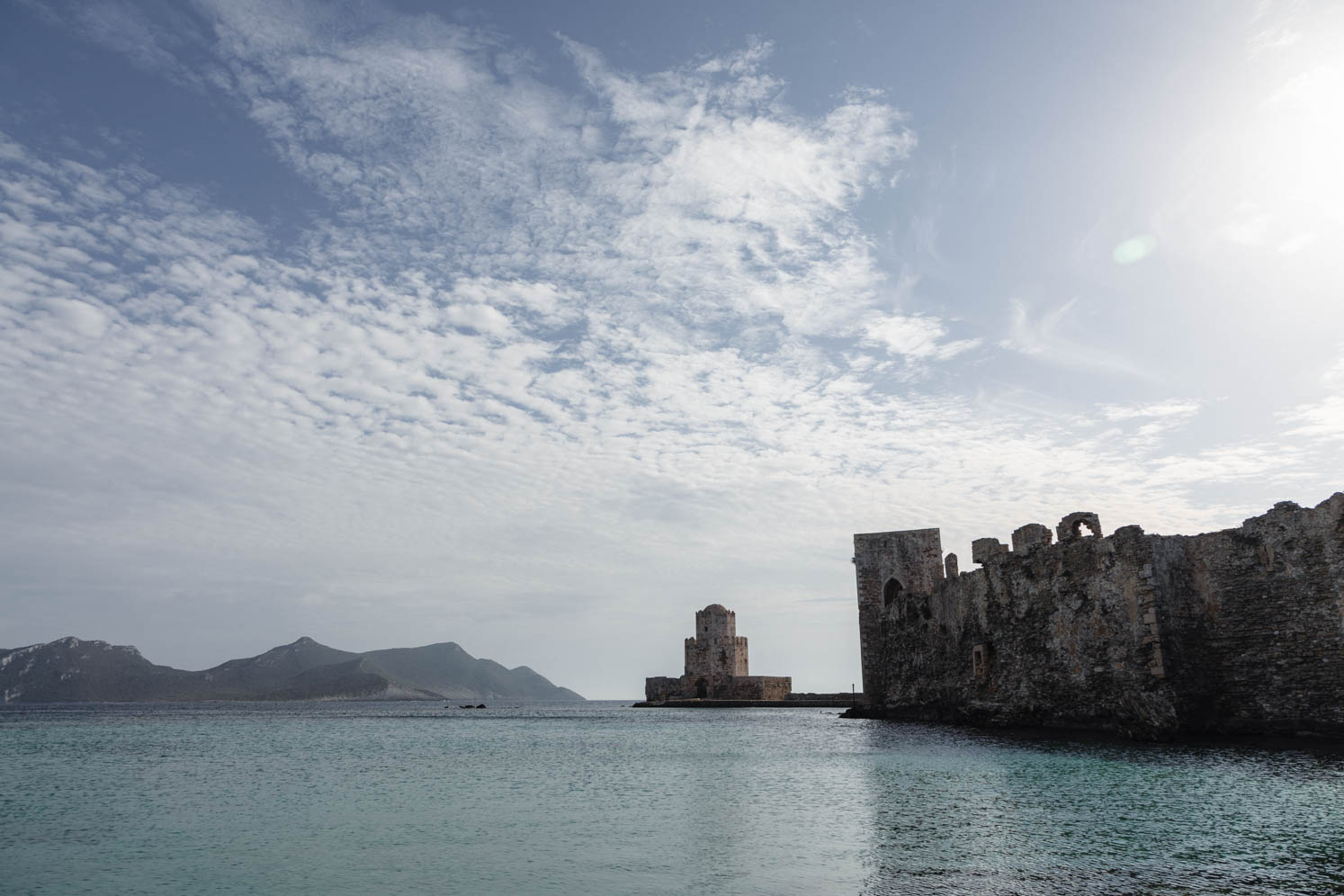
The Venetian fortress of Methoni has a long and interesting history. Built in the 15th century and up to 1828, the old town Methoni was within the fortress walls. After 1828, the inhabitants left the old town for the new and modern part.
The defensive tower Bourtzi, also the southernmost point of the castle of Methoni, is the landmark of the town. We found Methoni a characteristic town, especially because of the fortress and its location by the sea.
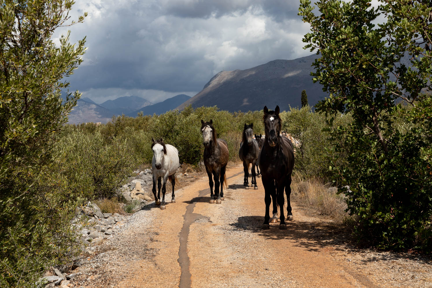
Mesá Máni. We made a long walk to the farming village of Charouda. We love the landscape of the Máni, often desolate, and the architecture. While walking, a small herd of horses followed us curiously. Near the village of Charouda, surrounded by cypresses, cedars and olive groves is a beautiful old church from the 11th century, the Taxiarhis church. Unfortunately, the church was closed. In our Greek period, the churches were always open. Unfortunately, a lot has been stolen from the churches. Near Charouda, in the village of Drialos, there are two churches built at right angles to each other.
Geroliménas. A small port town, with some dilapidated houses. The coast is very beautiful. The town is free of mass tourism, making it a nice place for us to be there. Walking there during the golden hour was a nice experience.
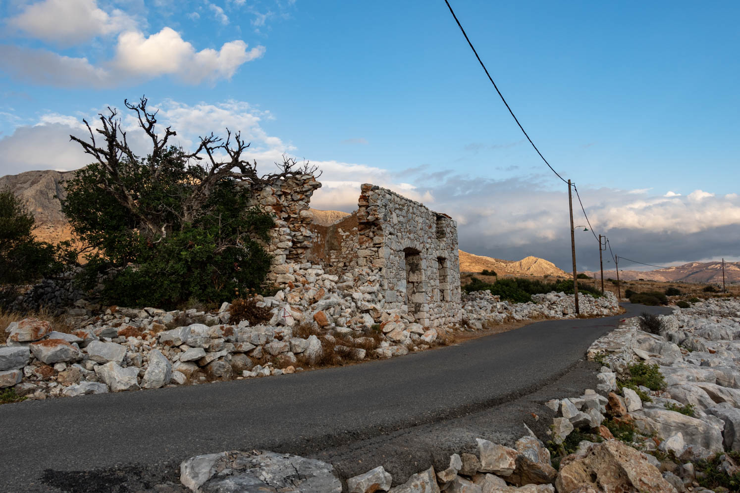
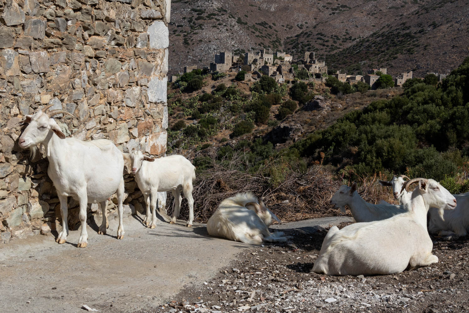
Váthia, the most famous tower village of the Máni. From the main road you can see the famous and much photographed “skyline” of Váthia. The village itself is still original with unexpected vistas, gates, rough stone walls. From Váthia we took the spectacular inner road from Alika to Lagia.
Monemvasia was the medieval seaport and commercial center of the Byzantine Peloponnese, the secular counterpart of Mystra. Today, the lower town is a fascinating mix of atmospheric heritage, careful restoration and sympathetic redevelopment in matching stone and style and an experience that should not be missed.
It is a beautiful old town. Extraordinary architecture and use of color. We found it oriental because of the colors and shapes of the houses. Just like in Ancient Messene, a lot of work has been done here since our last visit in 1999.
Monemvasia is also called the Gibraltar of the East. It is located on a high rocky peninsula, which is connected to the mainland by a narrow strip and a bridge. Monemvasia literally means “single entrance” and this location determines an important part of the history of the city.
Leonidhion. From Monemvasia, where we had stayed overnight, we followed a beautiful route through the mountains, through the Dafnon gorge: Monemvasia – Skala – Geraki – Kosmos – Leonidhion. We also passed the Elonis monastery built against the rock wall.
Leonidhion is a beautiful town, surrounded by the red-colored mountains. Strolling through the town, you will see architectural gems. Some houses have been very nicely and expertly restored. Leonidhion is a lively city with a lot of atmosphere, shops and tavernas. The Dafnon River flows through the city. There are three bridges that cross the river. The river had now dried up, but it will be a spectacle when the Dafnon flows through the town like a wild stream from the mountains and flows into the sea.
Ancient Corinth en Acrocorinth. Unfortunately, we were late for Acrocorinth. It closed at 15:00. We did take some pictures. We made a short visit to Ancient Corinth. We have visited both sites extensively in the past. Both sides are very interesting to visit.
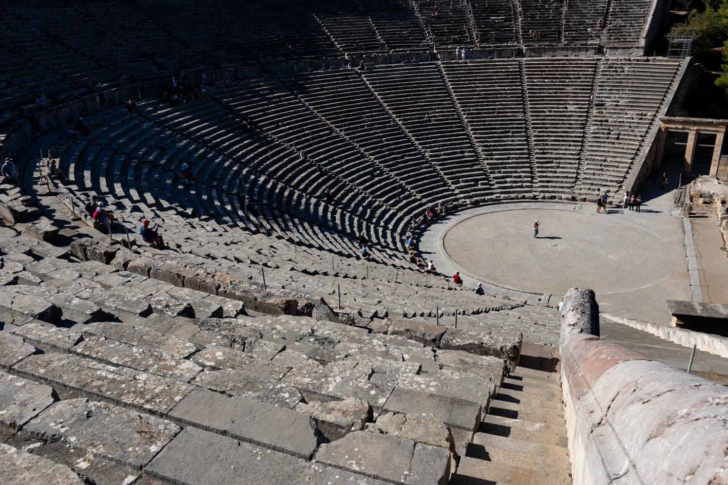
Epidavros. The amphitheater of Epidavros is the most famous from ancient times and the best preserved. Even today, classic dramas are performed in the summer. The oldest part was built in the 3rd century BC. The theater is located on a beautiful spot on a slope amidst beautiful green nature. The theatre has a capacity of 12,000 – 14,000 seats. The acoustics are impressive.
Caves of Didyma. On the main road between Kranidi and Epidavros, near the village of Didyma, are the Didyma Caves – two extraordinary sinkholes. They collapsed thousands of years ago, leaving large craters in the Earth. One hides a surprise – a small Byzantine church, Agios Georgios, built under a crevice dating from the 13th century, decorated with ancient frescoes and there is a small cave-like chapel of the Metamorphosis tou Sotira
The truth is that we only heard about the Metamorphosis chapel later, so we unfortunately missed it. We found this place and the Agios Georgis magical. Of course, we must go back to discover the Metamorphosis as well. It is certainly not a punishment to go back
Nafplion. After the independence of Greece Nafplion became the first Greek capital (1829 -1834), here the first Greek government and parliament settled. Nafplion is one of the most beautiful cities in Greece. Beautiful neoclassical buildings, large squares, shopping streets with bougainvillea with next to it the harbor and the imposing fortresses and castles. A little higher in the city you have a beautiful view over the city, the harbor, and the water with the characteristic fortress Bourtzi.
However, there is one downside and that is that this beautiful city is mard by the graffiti everywhere, even on historic buildings. Too bad, and we hope that the graffiti will at least be removed from these buildings. Beautiful murals have been made at the school.
We strolled through the city and took a walk to Agia Moni with a beautiful old spring, which is still in use.
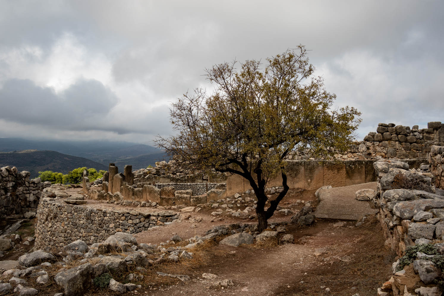
Mycenae is located east of the main road from Corinth to Nafplion in Argolida. It was in ancient times a city that was the most important political and cultural center of the Mycenaean civilization named after Mycenae. The heyday of Mycenae falls in the period between ca. 1400 and 1200 BC. The Mycenaeans developed a rich culture, which was mainly a further development of the Minoan civilization. Mycenae plays a role in Greek mythology, e.g. in the Trojan War. According to Homer, Mycenae was the city of King Agamemnon, the commander-in-chief of the Greek army, which fought against Troy.
Mycenae is surrounded by an enchanting landscape. Landscape with Gods, is the title of a book by Gaston van Camp. This applies to Mycenae and many places in Greece. Because of the dogs we could not visit the site together. Yvonne had beautiful weather with even some sun, with me it was raining cats and dogs. It was a nice first visit to Mycenae and we have a nice series of photos of Mycenae, partly due to the dramatic weather.
Kalávryta. In the trip to the Peloponnese we really wanted to go to Kalávryta. We wanted to pay tribute to the victims of this city that was hit so hard in WW2. On our previous trip we have been in Distomo and now Kalávryta. I also connect the visit with the shooting of my grandfather on the first day of the war and the grief that my mother carried with her throughout her life, but certainly also with the period that my father, from the age of 18, was forced to spend in Germany for the “Arbeitseinsatz”
The sad story of Kalávryta (Source: Lychnari – Ángelos Avgoustidis)
On December 9, 1943, the 117th mountain brigade of the Weermacht entered Kalávryta, a small Greek mountain town in the Peloponnese. On their way to Kalávryta, the Germans left a trail of death and destruction. Among other things, they destroyed two historic monasteries and executed the monks. They were out for revenge after the murder by the Greek partisans of 77 of their captured comrades. Once in Kalávryta, the Germans initially limited themselves to destroying the homes of alleged insurgents. But on the morning of December 13, they ran out the bells and gathered all the inhabitants. Women and children were locked up in the primary school while the men aged 14 and over were taken to a mountainside where they could see how all the buildings in the city were systematically looted and set on fire. The loot was taken away by local train. The Germans then executed all the men with machine guns and left. The slaughter lasted an hour and a half.The women who managed to escape from the burning school found their men in a pool of blood and spent two days burying the bodies. They were left alone, in the middle of winter, without a home and without food. In the chaos that followed, it was not immediately clear how many people were killed in Kalávryta because many residents had already left the city, while others, from the surrounding villages, had sought refuge there. The figures vary between 500 and 1200 deaths. 13 men survived.
The monument makes a big impression if you know the story behind it. What also made an impression is the left bell of the village church that stands still forever at the time of this senseless massacre, 2.34 am.
In the immediate vicinity of Kalávryta is the monastery of Agia Lavra, which has a place in the heart of every Greek. Here, on March 25, 1821, the country’s independence was proclaimed by Bishop Germanos of Patra.
Gulf of Corinth and Corinth Canal. When we returned from Kalávryta, an impressive drive through the mountains, we drove via the old coastal road from Diakoftó along the Gulf of Corinth to the Corinth Canal. It is a ribbon of villages. Quite a nice road to drive with beautiful “still life” along the sea. For example, old bus stops or a lost chair. The Corinth Canal remains impressive. It is a pity that we have never seen a big ship sailing through the canal.
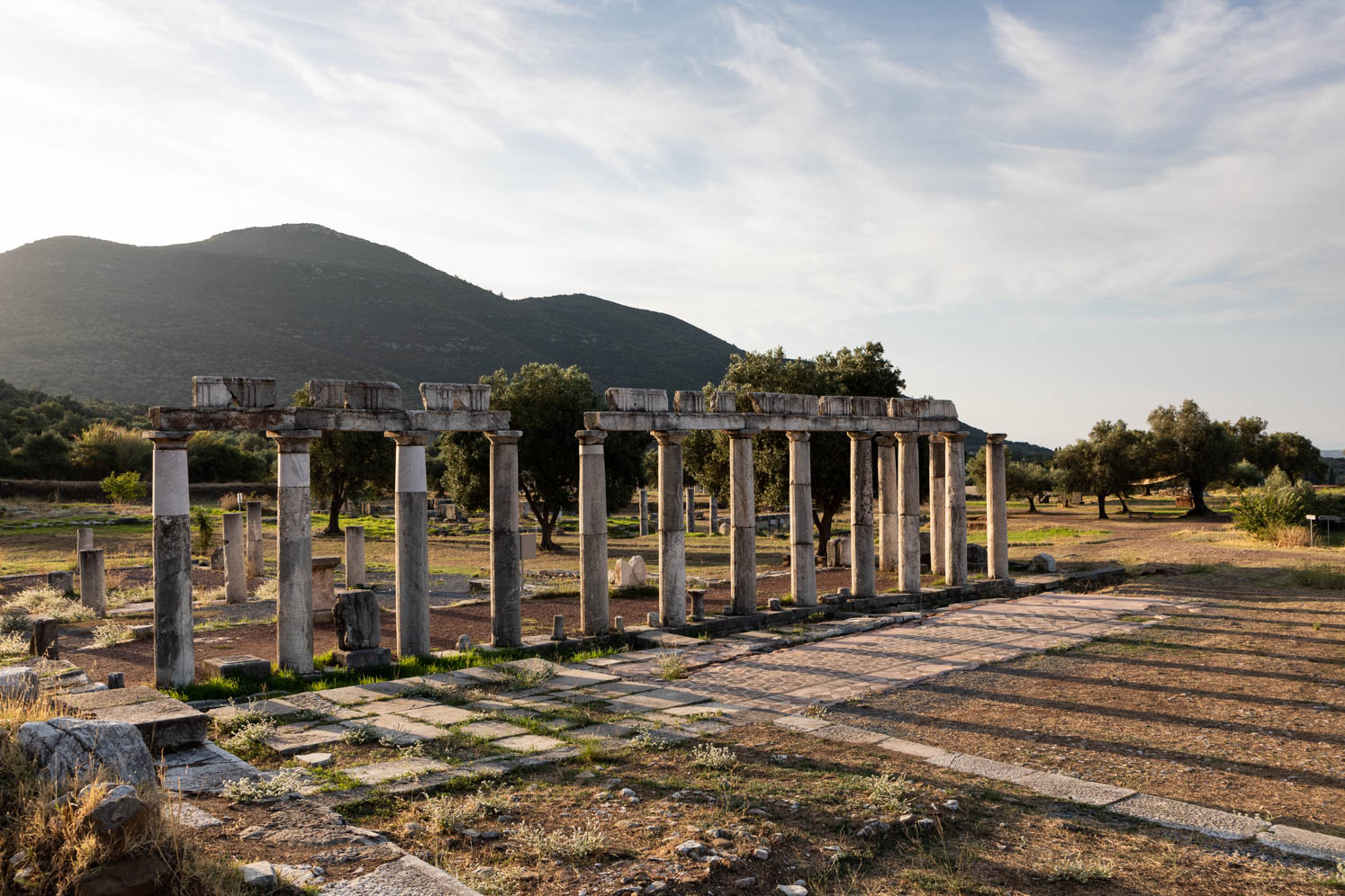
Loutraki Perachora peninsula. The road from Perachora to Lake Vouliagmeni descends through pine-covered hills. There are also many characteristic, sometimes centuries-old, olive trees. From the lake, the road continues for another 2 kilometers to Cape Malagkavi and the lighthouse, while the other descends to the archaeological site of Heraion of Perachora.
Heraion of Perachora
The site is not spectacular, but is set, again, in beautiful scenery, making it well worth visiting. The sanctuary of Heraion was dedicated to Hera, the goddess of women, marriage, childbirth, and family. Except for the main temple of Hera Akraia, several other buildings were discovered during excavations, including stoa, reservoirs, fountains, dining rooms and possible second temple of Hera Limanaia.
Our travel books
- Pelopónnesos by Bartho Hendriksen and Leo Platvoet. Publisher Babylon – De Geus
- The Rough Guide to Greece
- Travel handbook Pelopónnesos – Henk Buma. Publisher Elmar
- WOMO- Reihe Band 19 – Mit dem Wohnmobiel auf die Peloponnes – Reinhard Schultz and Waltraud Roth-Schulz
Comments are closed.