Travelogue – Greece 2022
travelogue
Greece 2022
In the fall of 2021, we made a tour on the Peloponnese and visited the island of Kythira and we traveled through Epirus for a few days. In 2022 we returned to Greece in the spring. In the Peloponnese we wanted to (re)visit a number of archaeological sites and explore Thessaly, Macedonia, Thrace, and Epirus. On our way to Greece, we visited Pietrasanta, Lucca, Pisa and Trani in Italy. In Bari we took the ferry to Igoumenitsa.
We drove about 10,000 km during this trip, of which 4,220 km in Greece
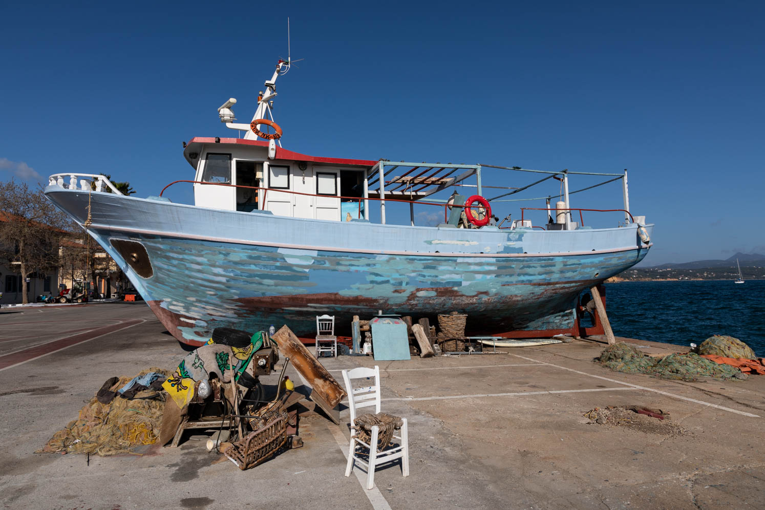
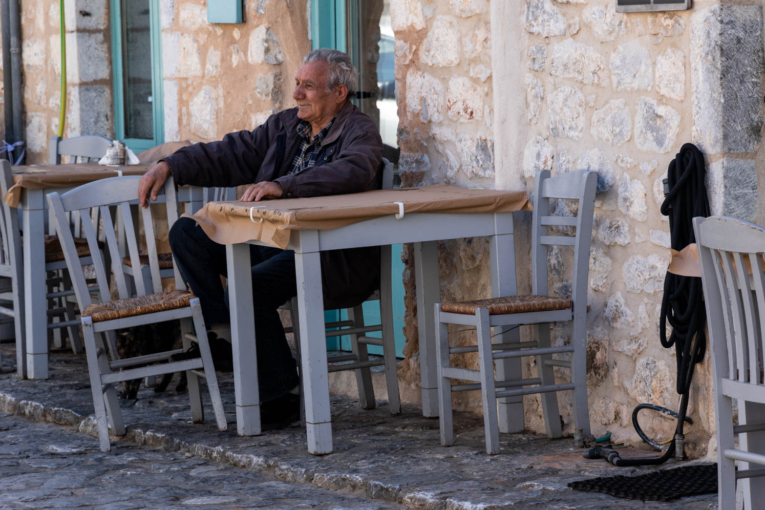
Photo series
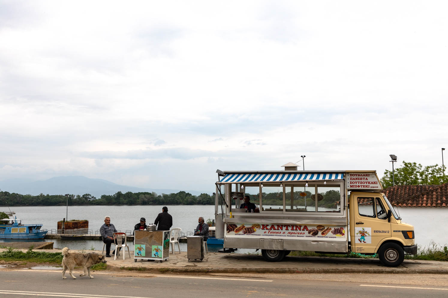
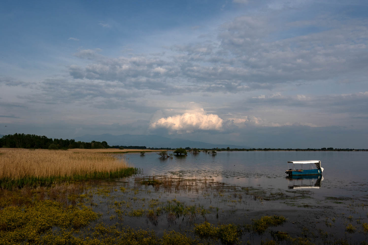
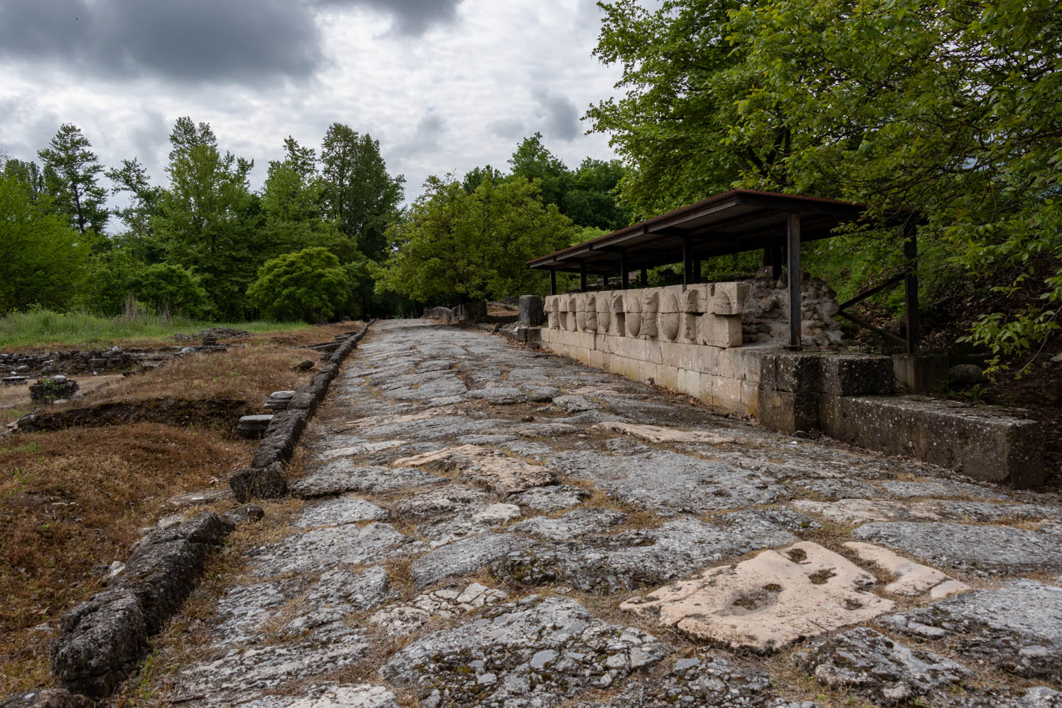
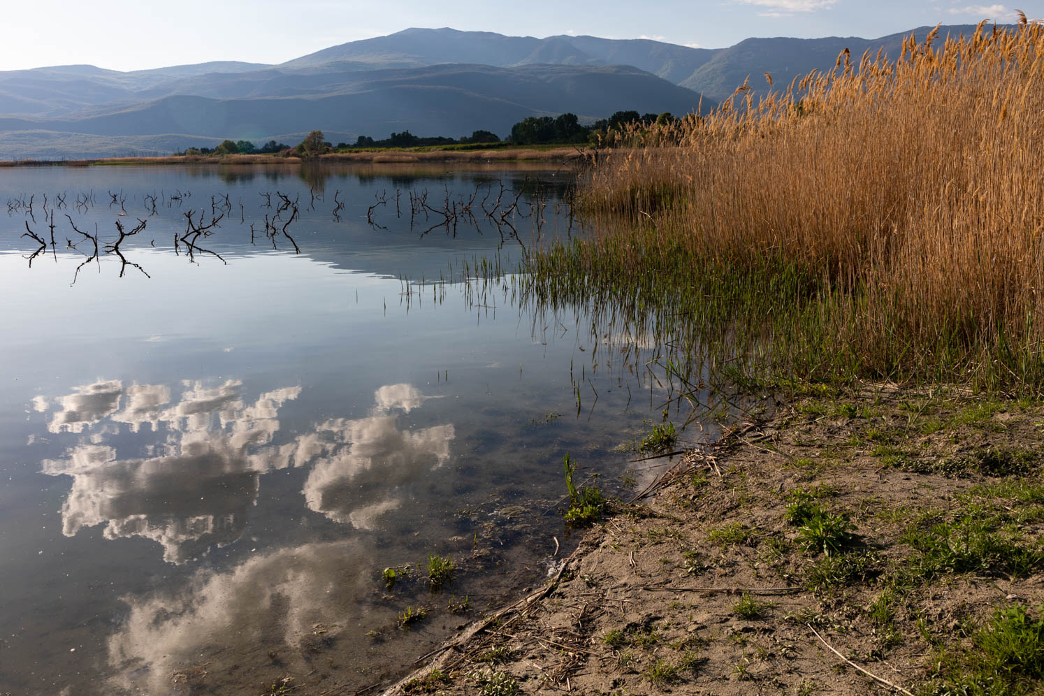
We have now published all photos of this journey on SmugMug, Together with the photos that we made during our travels in 2017 and 2021 we have organised all photos in regional series. Here below, meant as a teaser, a small selection of the photos that we made in 2022.
If you want to see the whole series please visit our photo site on SmugMug (click).


Route
From Igoumenitsa we descended via Patras, via the west coast, to the south of the Peloponnese. Via the east coast of the Peloponnese, we drove north. Crossed to Evia and then travelled through Thessaly, Thrace, Macedonia, and Epirus. The orange icons give an indication of our route and the places we have visited.

Highlights of our trip
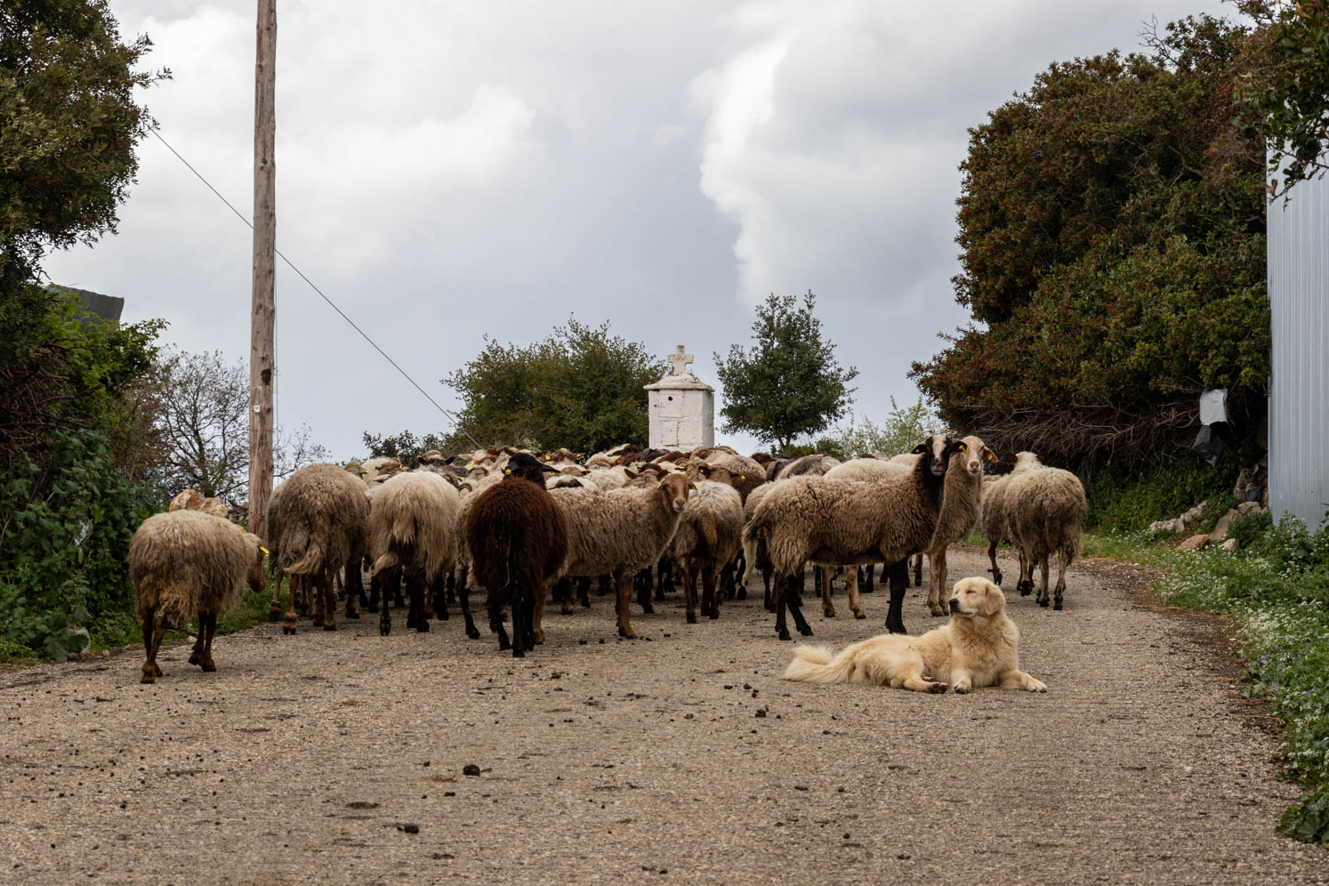
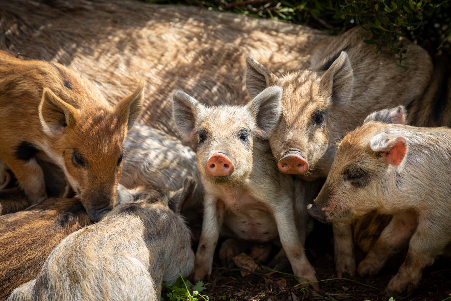
Plagía
Plagía was destroyed in 1953 by the earthquake that occurred on the nearby island of Kefalonia. The remains of the abandoned houses are reminders of this disaster. The village now houses pigs, goats, cows, dogs, chickens. It must have been a beautiful village, unique also because of its location. The catastrophic earthquake of 1953 in Kefalonia, in the Ionian Sea is one of the biggest disasters that has ever happened on the Greek island of Kefalonia. Kefalonia is located just east of a large tectonic repture. This is where the European and Aegean plates meet. In August 1953, there were even four earthquakes that hit the island. These earthquakes destroyed almost every home. The worst earthquake measured 7.3 on the Richter scale. The center was on the southern end of the island which was raised by 60 cm
Olympia
Perhaps not the most beautiful site in Greece, but historically one of the most important ones. In ancient times, the Olympic Games were held here every four years, for more than 1,100 years. Due to destruction and several earthquakes, little remains of the beautiful temples and athletic facilities. But wandering between the trees and the ancient ruins you can imagine what happened here in the past. Athletes, working themselves into a sweat in front of an excited, raw, crowd.
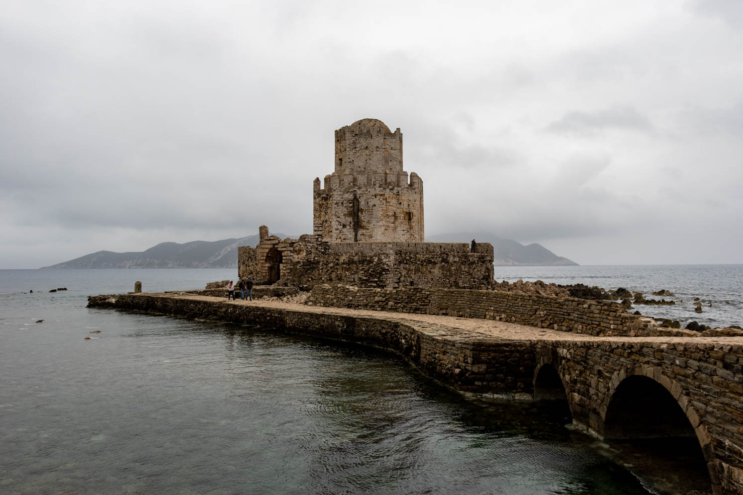
Methoni
Methoni is a picturesque town on the Ionian Sea. Due to its strategic position, it was an important trade- and maritime center. Hence the need to build fortresses. Built by the Venetians in the early 13th century on a rocky promontory, Methoni castle is one of the largest in the Mediterranean. Methoni itself used to be situated within the walls of this imposing castle. On the southern edge of the castle is a fortified island. Bourtzi, as it is called, a prison and place of executions during the Turkish occupation, was built in 1500 and is connected to the gate of the castle with a paved small road.
Hans Warren wrote once about Methoni: “Beautiful as a fortress, beautiful as a ruin. I had no idea how vast such a fortress could be.”
Koroni
Koroni is a very beautiful port town. We strolled through the town and along the harbor in the late afternoon and early morning. The light was beautiful. Koroni, like Methoni, has a Venetian fortress. In the fortress there are still houses inhabited. There is a church inside the fortress and a nunnery. We were the only visitors. The sun was shining. Lots of flowers in bloom. It was peaceful.
Areopoli
Areopoli is a well-preserved historic town with stone paths and traditional tower houses that were built for social and defensive reasons. It was the capital of the Mesa Mani. Like the rest of the Mani settlements, Areopoli is known for its contribution during Greece’s fighting against the Ottoman Empire. On the main square of the village “Platia Athanaton” stands the statue of Petrompeis Mavromichalis, the famous patriarch and descendant of the Mavromichali family. The Mavromichalis family originates from Areopoli and is widely known for their fighting spirit during the fighting against the Turks.
Agios Fokas
Last year we intended to spend the night here, but it was stormy and because of the high tide the church was not accessible. Now we could reach the church. Because of its location, on the small island, with a small cemetery around the church, it is a unique place. Regretfully, also this time, we unfortunately could not stay for the night with the camper. The wind, often strong gusts, made us decide to look for a safer place.
Monemvasia
We have been to Monemvasia a few times; we like to come here. For us Monemvasia has an Oriental atmosphere, and we find the architecture and the colors used beautiful. Monemvasia is in the southeast of the Peloponnese in the prefecture of Laconia, 400 meters on the land that was separated from the mainland by an earthquake in 375 AD. The name is derived from two Greek words, mone and emvassi, which means “single entrance”.It was founded by the Byzantines in the sixth century and shortly thereafter it became an important port. Today, a causeway connects the town of Yefira/New Monemvasia on the mainland with Monemvasia or Kastro (castle). The Kastro is divided into a lower and an upper town. Of the original 800 houses, many have been expertly restored, along with only four of the original forty churches can be found in the lower town. High above, castle walls protect the upper town at the top. There one can see the remains of Byzantine houses and public buildings and a huge cistern that provided a water supply in times of siege.
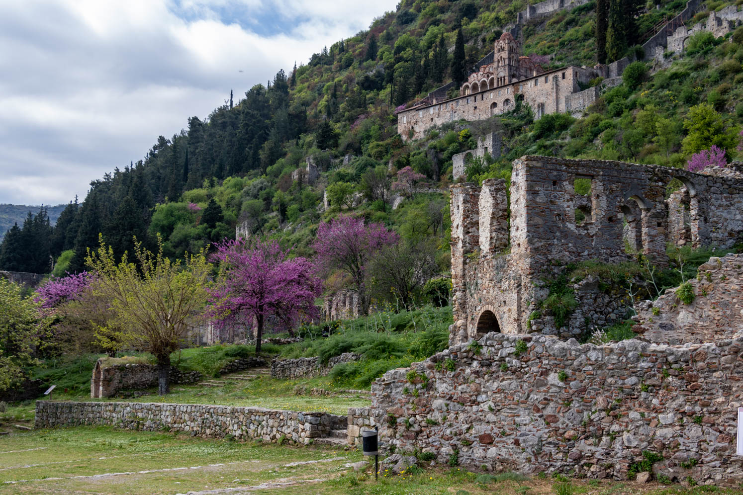
Mystras
Mystras is a Byzantine city built in 1249. On top of a hill, an offshoot of the Taygetos Mountains, a castle or Frankish fortress was built at an altitude of 620 meters with a view of Sparta. The strong fortress of Mystras was built to better defend Sparta. Mystras or Mistras was also called the “Miracle of Morea” because of the many beautiful churches, murals, libraries and famous writers. Morea is a former name for the Peloponnese. Mystras is now a Unesco World Heritage Site in a beautiful landscape.
Odyssey: With its restored churches and monasteries, palaces, ruined houses, gates and alleys, Mystras is one big open-air museum. An open-air museum of medieval Byzantine architecture, painting and sculpture.
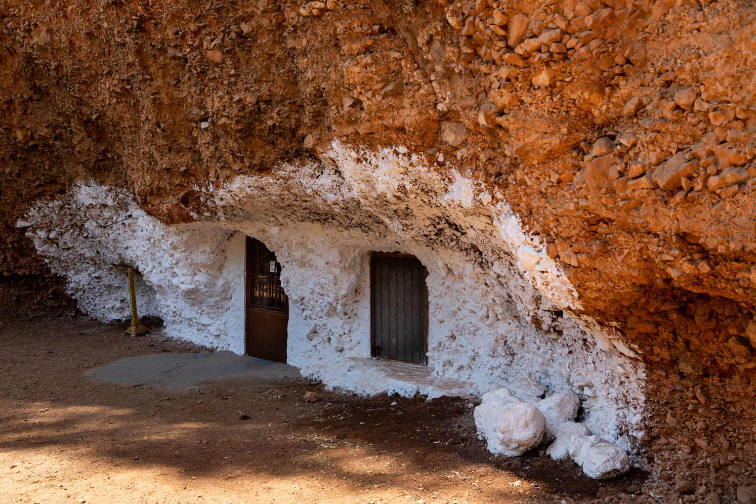
Didyma
Didyma is in a beautiful valley at the foot of the mountains of the same name. The village is known for the huge craters that lie nearby. The ‘dolines of Didyma’, as they are called by the population. The craters were created because a piece of land has sunk due to underground currents and a low plain has been formed between a high fence of earth and clay. This natural phenomenon is called sinkholes. The smallest crater is located in the valley near Didyma and is overgrown with pine trees and bushes. In this crater there are two chapels from the Byzantine and Post-Byzantine periods. One chapel is dedicated to Agios Georgios and the other to the Metamorfosis. We had missed the Metamorfosis chapel last year, hence our second visit. In the chapel of Agios Georgios you can still see inscriptions in Latin, as well as an old stone baptismal font. A tunnel on the side of the doline forms the ancient entrance to the cave. The steps inside the tunnel are handmade.
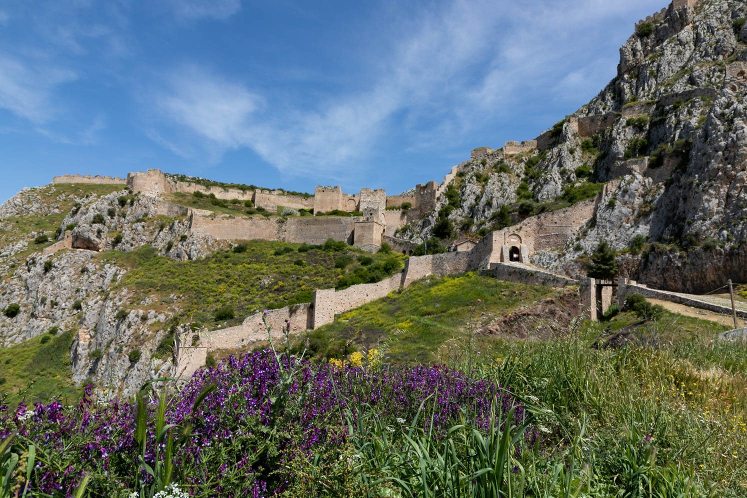
Acrocorinth
High above ancient Corinth are the ruins of one of the most beautiful natural fortifications in ancient Greece. The unparalleled vantage point that controlled the Isthmus of Corinth, plus the availability of mineral water, made this a powerful defensive position. The original fort has been modified many times over the centuries by a series of invaders. Inside the gates there is a mixture of imposing Roman, Byzantine, Frankish, Venetian and Turkish ramparts, with remains of Byzantine chapels, Turkish houses and mosques. The walls are about 3 km long.
Because I had sprained my foot in Olympia, it was up to Yvonne to make the big climb up. It’s more than worth it.
Evia
Unfortunately, Evia was not a success for us. From Halkida we drove north. The beginning was scenically very beautiful. Striking were the number of hives. Then, unfortunately, the the weather changed, and it started raining cats and dogs. But what depressed us most was the area destroyed by fires. Last year, a large part of Evia was destroyed by fire. It must be a disaster for the people who live here. Living from crisis to crisis. First an economic crisis, then Covid-19, and now devastating, ruthless, fires. We sincerely hope that this beautiful island recovers from all these disasters and that better days will come for the islanders.
Agia Kiriaki
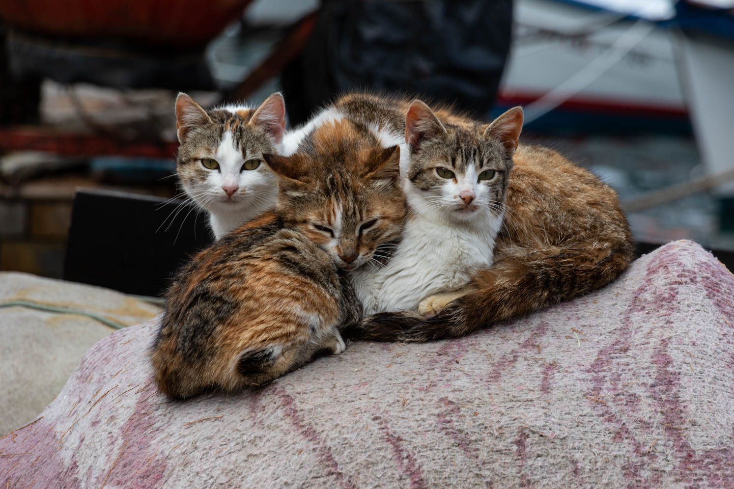
The Pelion is a beautiful peninsula. The south of the Pelion is quieter than the north. Trikeri is rugged and from the heights you have beautiful views of Evia and the mainland. We spent the night in Agia Kiriaki. We walked in Agia Kiriaki and photographed a lot. It is a Greek port town to our hearts with characteristic Greek scenes. Just like Hydra, it is a paradise for cats. A rewarding subject to photograph.
Soufli
In Soufli was an important silk industry, but in 1922 the town lost a lot of mulberry orchards to the Turks. In 1908 they produced 800,000 kg of cocoons in Soufli, in 1998 only 5,000 kg. The town still has characteristic houses from the 19th and 20th centuries.
Rodopi
Rodopi is the central region of the Thrace District and borders Bulgaria to the north , Xanthi region to the west, and Evros region to the east. The nature in Rodopi is very diverse: mountains, gorges, rivers, valleys, plains, but also beautiful beaches. The largest plain of Rodopi is the fertile plain of Komotini. Komotini is the capital of the Rodopi Prefecture. With 48.000 inhabitants, it is one of the largest cities in Thrace.
Xanthi
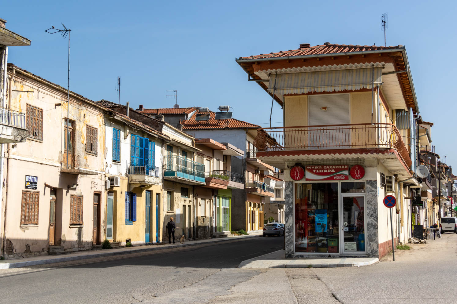
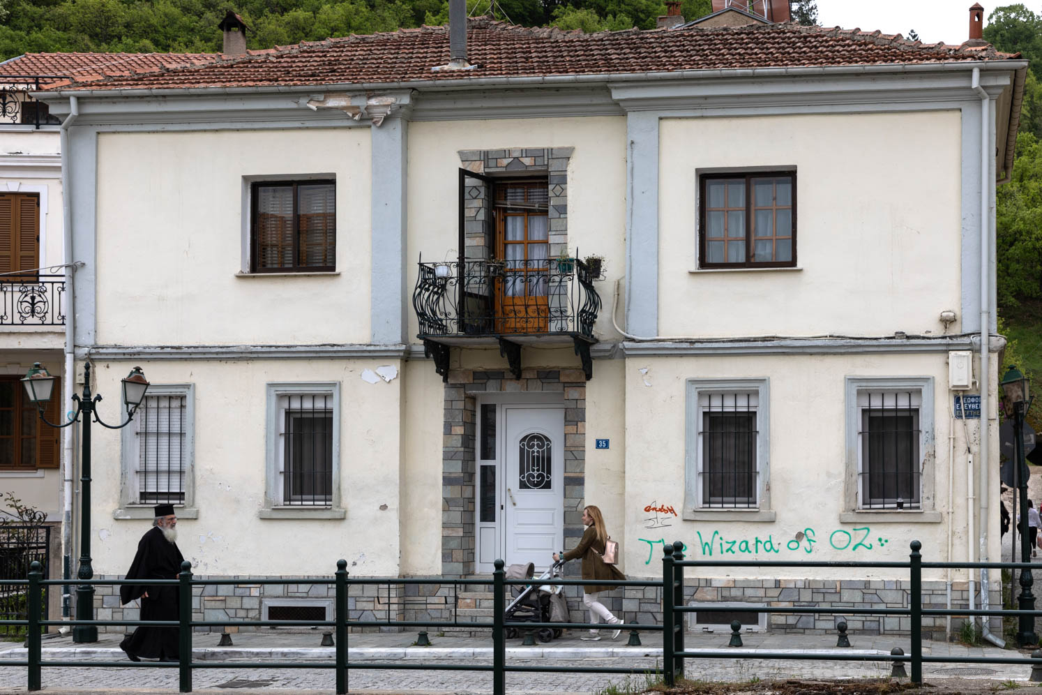
Xanthi is a traditional town and part of the city has a protected cultural status. Founded around the 9th century, Xanthi lies on the low slopes of the Rodopi Mountains. Next to the city flows the Kosinthos River. In the 13th and 14th centuries it was the most important city in the region, at that time it was called Xantheia. Xanthi is a nice city. Unfortunately, many characteristic houses are dilapidated and cannot be restored. Also, a lot has been ruined by graffiti. Too bad, the city has deserved much better.
Nestos
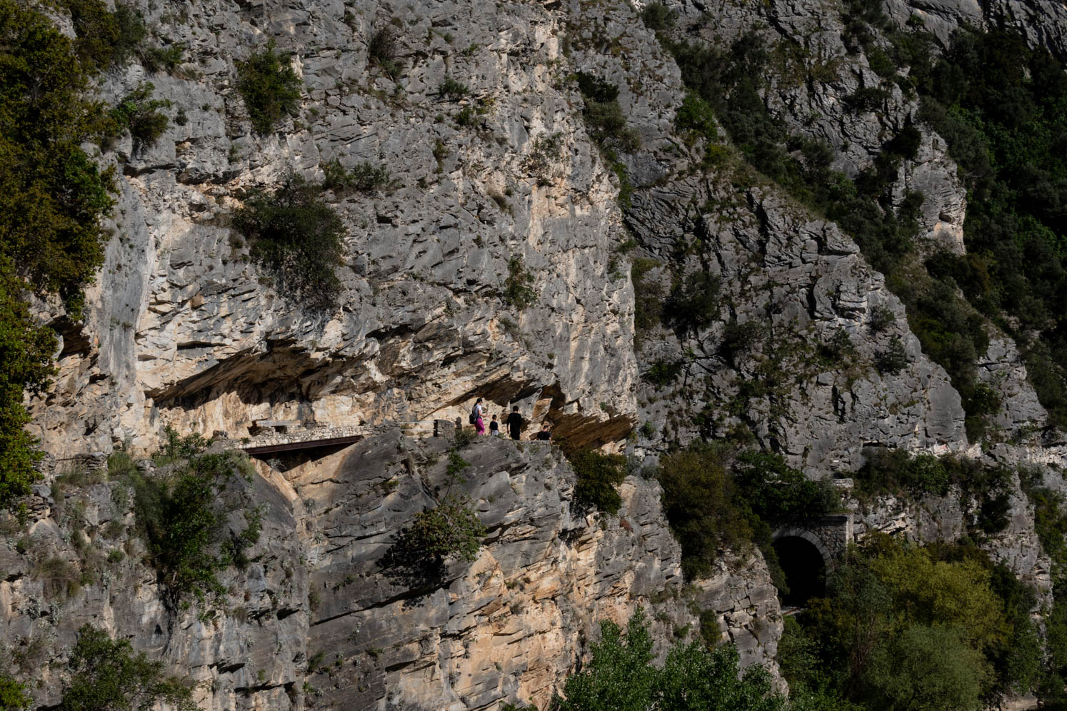
From Xanthi we made a ride through the mountains, via Stavroupouli, Livera and Toxodas. An exciting ride on narrow roads. We were very lucky that there was no oncoming traffic. At the highest point of the route there was a viewpoint with deep below the Nestos River. Safely down we made a walk through the Nestos gorge. Pretty spectacular.
Ancient Philippi
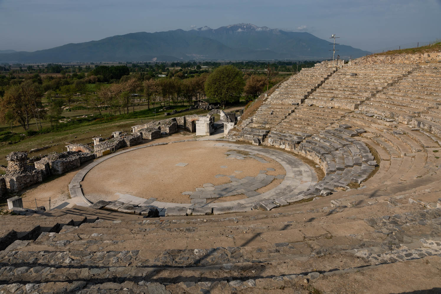
Perhaps not as well renowned as Delphi or Mycenae, but Ancient Philippi is an important and certainly impressive site. From an archaeological site I don’t need to know all the details. Walking through the remains, photographing, and taking in the atmosphere gives a lot of satisfaction. Philippi was founded in 356 BC by the energetic Macedonian dynasty Philip II, father of Alexander the Great. The old town is on the Unesco World Heritage List. By its strategic importance, controlling an important trade route between Europe and Asia, it became powerful in the Hellenic period that followed Alexander’s death. Highlights include the Hellenistic Theater, dramatic against the hill, the forum, and later remains of the Basilicas that were built when Philippi became an important center of early Christianity.
Limni Kerkini
Lake Kerkini is an artificial reservoir in Central Macedonia, which was built in 1932 and then redeveloped in 1980, on a site of what was previously an extremely vast marshland. Lake Kerkini is now one of the most important birdwatching sites in Greece, as it is located along the migratory route for birds en route to the Aegean Sea, the Balkans, the Black Sea, the Hungarian steppes and beyond.
Lake Kerkini is one of Europe’s most important Ramsar Wetlands. In Ramsar (Iran) there was a convention in 1971, where international agreements were made regarding wetlands. It is a beautiful nature reserve. Many species of birds, including pelicans. We spent the night in Mandraki. In the evening there was a concert of frogs, crickets and birds. Deafeningly beautiful.
Limni Kerkini is a magical place.
The graveyard of the Bogomils
This abandoned cemetery is located near the town of Nea Chalcedon. The stone crosses were placed by a Gnostic Christian sect. This sect, the Bogomils, was active in the Balkans between the 10th and 15th century. The sect originated in Bulgaria by the middle of the 10th century. The crosses are enclosed by a stone circle in a Celtic style.
Ancient Dion
The village of Dion is located 17 km southwest of Katerini. Here are the archaeological excavations of the Holy City of the Macedonians. In the middle of a richly vegetated and spring-watered field in the plain of Pieria, just before the climb to Olympus begins, the Temples of the Gods stretch out, including two theaters. Right next to it is the ancient city of Dion, whose God-bearing name clearly shows its close relationship with the God Zeus. (Dias). At this place thousands of Macedonians gathered for the festivals “the Olympiads for Dias” that were celebrated from the 5th century BC.
Vergina
Vergina is a historical place, 95 kilometers west of Thessaloniki in Macedonia. It is a hilly area located in the department of Imathia, 12 kilometers from the capital Veria. Vergina became world news in 1977 when Professor Manolis Andronikos discovered a number of tombs here. Philippos the 2nd, father of Alexander the Great, is buried in one of these tombs. The name Vergina only got the village in the 30s of the last century when Greek refugees from Turkey settled here. Vergina was the name of a queen who had lived here before the fall of the Byzantine Empire and the rise of the Ottoman Empire. The actual name of this place in ancient times was Aiges. Aiges was the first capital of the Macedonian kingdom, the empire of one of the greatest Greeks, Alexander the Great. In the tombs all kinds of objects have been found, many of which are made of gold. Very famous is the golden urn with the symbol of the Macedonian dynasty (star with 16 rays). In the beautiful museum you can admire all these treasures. Very impressive.
Limni Vegoritida
Limni Vegoritida, in the past also known as Limni Ostrovo is a large natural lake in western Macedonia. We drove around the lake. There are a lot of fruit trees, especially cherry trees. We spent the night in Arnissas and Aminteo. Both dream places for camping with a van. In the evening, families with young children, grandfathers and grandmothers came to the lake, feeding the birds and ducks. Very peaceful on this special day for us, 4thMay. In the Netherlands we commemorate the war victims with 2 minutes of silence. And sadly enough today another war is raging in Europe, not so far from here.
Prespa National Park
West of Florina in northern Greece, the two Prespa lakes are a breathtaking place, with a rich flora and fauna and history. At a million years old, Megali Prespa and Mikri Prespa are among the oldest lakes in Europe. Greece shares Megali Prespa with North Macedonia and Albania, and Mikri Prespa only with Albania. Wild animals abound. Brown bears, wolves and wild boars are just a few of the 40 mammal species, in addition to 260 bird species, including the world’s largest colony of Dalmatian pelicans in Mikri Prespa, as well as large white pelicans. Workers were busy cutting reeds, which is used to tie up the gigantes (large beans). We were with the camper in Psarádes. Cows with their calves greeted us. Just like in 2017, we found this area a paradise. We walked on the island of Agios Achillos with the beautiful ruin of the same name. We also visited some villages on the border with Albania. The second evening we were in Mikrolimni, near a small chapel. In front of us the mountains, the water, the reeds with the water birds. Unfortunately, we did not see bears. We did see a fox and some snakes and a lot of water birds.
Ghost villages of the Korésteia
The Korésteia, the name is derived from the ancient kingdom of Orestida, consists of some 22 ghost villages of red mud houses, once populated by people of Slavic descent who fought in the resistance and civil war, but now all abandoned and slowly returning to nature. Filmmakers and photographers love the villages for their atmosphere. We visited Kraniónas and Gravos. It seems that dog packs have taken possession of the villages. We were warned in Kraniónas that it could be too dangerous. In Gravos we were accompanied by a pack. We didn’t feel comfortable. When we got to the camper we gave the dogs some food, which made it less threatening.
Meteora
Meteora is a must for every traveler visiting Greece. We were here for the third time. We always try to be there before the buses with tourists arrive. Unfortunately, we still haven’t been able to photograph these beautiful, impressive monasteries with good light. If the buses have come with tourists, it is time to leave before you get too annoyed by the behavior of people, unfortunately also by camper owners who are averse to a camper ban.
Meteora is one of the most striking and impressive monuments of the world, protected by UNESCO. Centuries of wind and water erosion (once the Thessalian plain was an inland sea) have given the rock formations their specific appearance. From the 9th century, the natural sandstone towers were climbed by hermits who created their own habitat there and only occasionally came down. From the 11th century onwards, monks expelled elsewhere moved to the area. In the mid-14th century, the first monasteries arose on the peaks. At one time there were twenty-four monasteries, spread over the different rocks.
Moni Ypséseos
We made a beautiful trip through the mountains, where there was still snow on the high peaks, from Kalambaka to Moni Ypséseos. It is one of the most unusual churches in Greece. It is built entirely of stone and has 13 narrow towers. It would fit into an Anton Pieck drawing. The way back, via Megali Kerasia was spectacular, especially because we got stuck in the village, because of a road closure.
Katára pass
To Ioannina we took the Katára pass. The Katára pass is a mountain pass in the Pindus Mountains in northern Greece. The pass is located 5 km northeast of the city of Metsovo. Located on the border of Epirus and Thessaly, it forms the separation between the river basins of the Aoös in the southwest and the Pineios in the east. Its height is about 1,705 m making it one of the highest passes in Greece. The Greek national road 6 (Larissa – Trikala – Metsovo – Ioannina – Igoumenitsa) crosses the Katára pass. With the opening of the Egnatia Odos highway running through tunnels further south, traffic has decreased sharply. We also drove around the lake where the Aoös river originates. It is the highest mountain lake in Greece
Ioannina
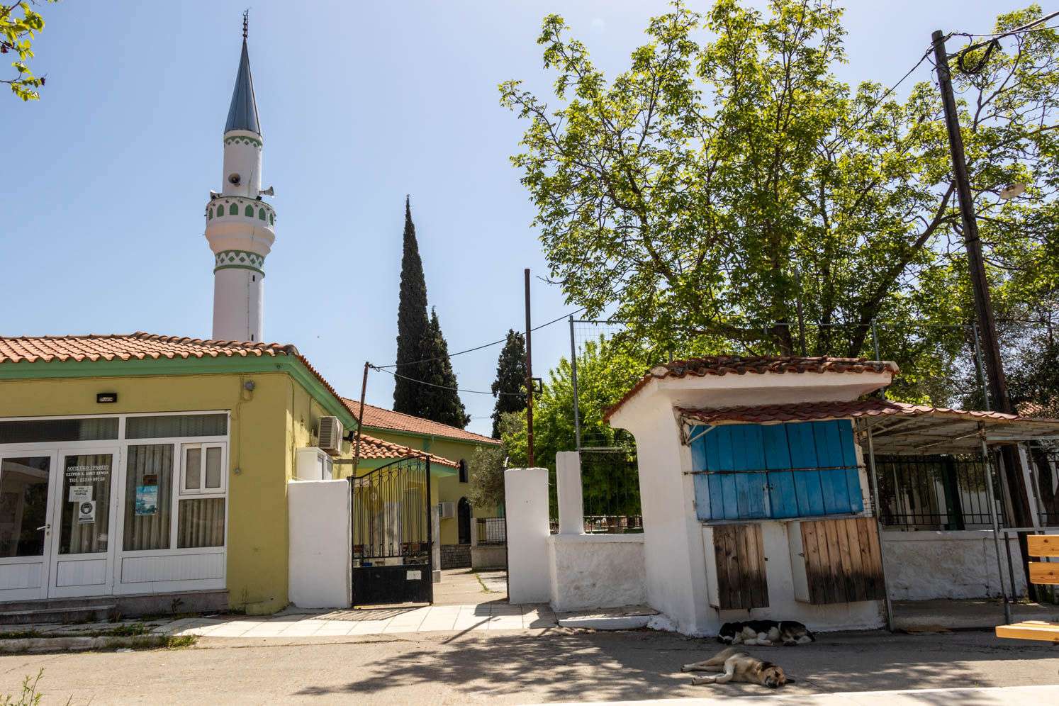
We spend the night in Ligkiadis, high on the other side of the Pamvotida lake. The view of Ioannina was beautiful during the day and in the evening. Ioannina is located on the western shore of the beautiful Pamvotida lake and is one of the most atmospheric cities of northern Greece. The walls of the old, fortified town, the Kastro, enclose a quiet neighborhood, dotted with minarets, and the islet of Nissaki in the middle of Lake Pamvotida. We strolled through Ioannina and visited a number of landmarks, including the Kastro, the Aslan Pascha mosque, the Fethie mosque, the Jewish quarter. The synagogue was unfortunately closed. Of course, we also walked along the lake.
Ioannina is definitely worth a visit, but it is chaotic and busy.
Land of the Souliots
We have also been here in 2017. The landscape and the harsh existence of the people in the villages impressed us. Eleven villages formed the Souliot Federation. Souliotes (also spelled Souliots or Suliots) were a belligerent community from the area of Souli, in Greece, that became famous throughout Greece for their opposition to the local Ottoman Pashalik of Yanina ruled by the Muslim Albanese Ali Pasha. After their defeat in 1803, the Souliotes were forced to move to the rest of Greece, and many of them played a prominent role in the Greek War of Independence from 1821 onwards. The native language of the Souliotes was Albanian
Acheron river
The Acheron River is one of the most beautiful and cleanest rivers in Greece. The color of the river is light turquoise. The Acheron features prominently in Greek mythology, where it is often depicted as the entrance to the Greek underworld where souls must be crossed by Charon.
Travel guides
- Bradt guide Northern Greece – Dana Facaros
- Bradt guide Greece The Peloponnese – Andrew Bostock
- The Rough Guide to Greece

Comments are closed.